Budapest, September 19th, 2024 – Emlid, the European manufacturer of Reach RTK GNSS receivers, announces major updates to its Emlid Flow mobile and cloud app. Upgraded with Surfaces support, Emlid Flow now has a full range of tools for earthworks, topographic, and as-built surveys. Paired with survey-grade Reach receivers, the app brings efficiency improvements to land surveying and construction workflows.
Survey gear and software for pro-surveying
This year, Emlid has released a series of new survey features in the Emlid Flow app, including advanced linework, inverse and traverse, polygons, and the auto collection mode.
One of the core tools—extended Surfaces support—was released earlier this month. The feature is designed for earthwork and allows surveyors to add DTM models to their projects to calculate the cut & fill values during the stakeout.
The goal of the developers was to create an uncluttered surveyor interface while maintaining all necessary controls. With well-organized navigation and instant sync with the cloud, Emlid Flow enables surveying professionals to complete their tasks with fewer steps—all on their preferred device, be it a ruggedized Android smartphone or an iPad.
As a native app for Reach receivers, Emlid Flow works smoothly with all Emlid devices. Seamless compatibility with Reach receivers saves time in the field eliminating any connectivity concerns. The combo of Emlid Flow and the flagship Emlid’s Reach RS3 receiver with tilt compensation now covers all popular survey scenarios: from topographic surveys and site layout to as-built surveys and bulk earthworks.
Surveying workflows from A to XYZ
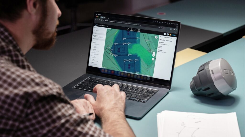
Emlid’s software ecosystem includes the Emlid Flow mobile app and its Emlid Flow 360 cloud version. The data is instantly backed up and synced between both, enabling seamless field-to-office workflows.
Prepare and manage projects
From the office, surveyors can prepare projects using any browser with Emlid Flow 360. This includes creating a project, adding coordinate systems, code libraries, or WMS background layers, uploading data, and calculating geometry for stakeouts. The prepared project is immediately available in the Emlid Flow mobile app. Once the job is complete, the data is ready for export in Emlid Flow 360 right away.
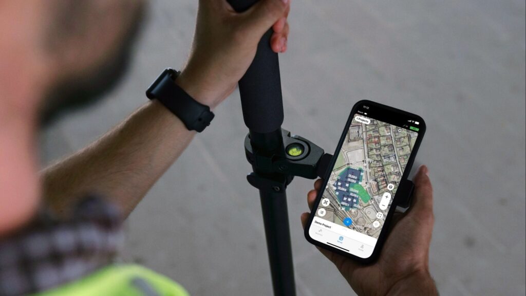
Survey in the field
To survey any objects with less effort, the Emlid Flow app supports advanced survey workflows:
- Configuring Reach receivers as a base and rover
- Collecting points and lines
- Staking out points and lines
- Auto collection
- Applying survey codes
- Localization and base shift
- Inverse & Traverse calculations
- Cut & fill calculations
- Using background maps and WMS layers
- Stakeout reports
- Export/import data in CSV, DXF, SHP, and KML
- Using customized CSV, and more.
The mobile app is available for both iOS and Android devices. Even if a smartphone is discharged in the field, a surveyor can log into their Emlid account on another device to access all survey data right away.
How to get started
Emlid Flow offers Free and Survey plans. The receiver configuration and basic features for data collection and stakeout come for free. The advanced features are available with the Survey plan. A single subscription for both Emlid Flow and Emlid Flow 360 comes for $240/year if billed yearly (local taxes may apply). Download the app and get a subscription with a free trial at emlid.com/emlid-flow/.
About Emlid
Emlid manufactures high-precision RTK GNSS receivers and software for the field and office. Built to provide centimeter-level positioning even in challenging conditions, Emlid Reach receivers are used for surveying, GIS, construction, drone mapping, and more. Headquartered in Budapest, Hungary, Emlid ships Reach receivers worldwide from its online store and official dealers.
