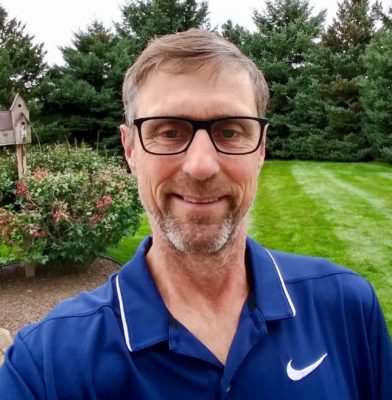
Michael has spent the past 32 years in aerial mapping and geospatial services. He started his professional career at the aerial mapping firm Western Air Maps in Kansas City Kansas and then worked at Advanced Mapping Technologies in Traverse City, Michigan.
Most recently, Michael spent the past 11 years heading the national drone program and photogrammetry departments for Westwood Professional Services in Overland Park, Kansas. He has flown and/or oversaw the flying of thousands of drone missions, providing LiDAR acquisition and processing, UAV training, photogrammetric processing of drone images and producing high accuracy topography maps and stockpile volumetric reports. Michael received his Associates Degree in Photogrammetry from Ferris State University in Big Rapids, Michigan.
Michael Singer, CEO of DroneView Technologies, adds, “Michael brings extensive aerial mapping experience and geospatial expertise. He will enhance DroneView Technologies capabilities further in many areas including UAV LiDAR, manned imagery and LiDAR acquisition and processing, high accuracy RTK/PPK drone mapping, drone training, among others. We are very excited to have Michael join our growing team.”
About DroneView Technologies
DroneView Technologies is a leading aerial mapping and geospatial services company serving enterprise customers throughout the US providing high precision mapping, topography and stockpile measurements. Acquiring aerial images and LiDAR using drones or manned aircraft, DroneView Technologies works throughout the United States for civil engineers, surveyors, earth moving, construction, airports, energy, landfill, mining and aggregate companies among others.