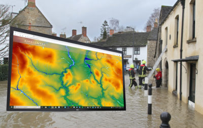
“Our flood map products are used around the world by insurers, government agencies, property developers and emergency response services to visualise, assess and understand potential flood risk,” commented Mark Nunns, Technical Account and Sales Manager at ARA. “This means they need to be accurate, up-to-date and easy to use. Working with Bluesky we have been able to increase the accuracy, detail and cover of the topographic data outside of other LiDAR coverage. This allows for a more accurate flood model output and a better representation and understanding of flood risk.”
Also known as bare earth models, the Bluesky height models were used to enhance ARA’s national scale topographic flood map dataset UKFloodMap. Using proprietary software Flowroute-i, ARA has integrated the Bluesky DTM data to provide an accurate ground elevation surface over which different water flows can be modelled. UKFloodMap includes all primary flood sources, including fluvial (river), tidal (sea, estuary, coastal) and pluvial (flash, surface water) as well as secondary sources such as flood defences, dam breaches and groundwater.
UKFloodMap includes two layers of data; depths and velocities, offers a range of modelled return periods from 30 to 1,000 years and can be delivered in a range of formats including GIS (Geographical Information Systems) ready layers and in database or API format, linked to all UK addresses via ARA’s FloodScore product suite.
“The DTM data supplied by Bluesky was easy to work with and easy to integrate within our existing processes and outputs,” continued Nunns. “The support from Bluesky was excellent and we are looking forward to working with them to develop new products in new territories.”
ARA is a leading provider of flood risk modelling and advanced data and risk analytics. Working across a range of industry sectors, but with a key focus on insurance, ARA offers a range of solutions, including flood risk insurance analytics and climate change adaption and a range of products including flood maps, property-level flood risk information and flood modelling software.
About Bluesky
Bluesky is a specialist in aerial survey including aerial photography, LiDAR and thermal data, using the very latest survey technology, including two UltraCam Eagles and a Teledyne Optech Galaxy LiDAR system integrated with a PhaseOne camera and thermal sensor. An internationally recognised leader with projects extending around the globe, Bluesky is proud to work with prestigious organisations such as Google, the BBC and Government Agencies. Bluesky has unrivalled expertise in the creation of seamless, digital aerial photography and maintains national “off the shelf” coverage of aerial photography, DTM and DSM through an ongoing three-year update programme. By purchasing a world first sensor for the simultaneous capture of LiDAR, Thermal and Aerial Photography data, Bluesky is in the enviable position of being able to provide customers with unique and cost effective solutions. Bluesky is leading the way in developing innovative solutions for environmental applications, including the UK’s first National Tree Map (NTM), solar mapping and citywide ‘heat loss’ maps and is currently developing noise and air quality mapping products. Bluesky is also the first company to offer CityMapper (simultaneously captured vertical, oblique and LiDAR) data in the UK. https://www.bluesky-world.com/